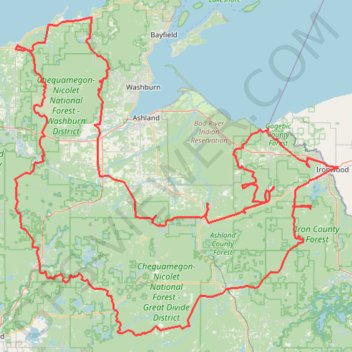
Wisconsin Northwoods Waterfall Loop
- Distance : 612,5 Km
- Dénivelé positif : 5 903 m
- Altitude maximum : 542 m
- Dénivelé négatif : 5 902 m
- Altitude minimum : 177 m
Carte interactive de l'itinéraire
Profil de l'itinéraire
- Distance : 612,5 Km
- Dénivelé positif : 5 903 m
- Altitude maximum : 542 m
- Dénivelé négatif : 5 902 m
- Altitude minimum : 177 m
À propos de cet itinéraire
Nom : Itinéraire Wisconsin Northwoods Waterfall Loop, distance, dénivelé, altitude, carte, profil, trace GPS
Coordonnées : 46.01476 -91.39266 46.85596 -90.14145